Guest Essay by Dr. Eugenio González, Director, The Soltis Center for Research and Education in Costa Rica, Texas A&M University.
Preface by Dr. Deedra McClearn, scientific advisor to OTS.
Research projects often expand in new and unanticipated ways. That has certainly been the case with the data rescue effort for the La Selva CANADA PLOT native tree initiative. The goal of Phase 1 was to put the original seedling data from 35 years ago into a permanent data repository. After considerable time and effort, that phase was successfully completed in 2021.
Phase 2 was prompted by the questions “Can we still find the original trees 35 years later?” and “If so, can we tag and remeasure the trees with the goal of looking at survival and growth rates?”
This report takes a quick look at the successful completion of Phase 2 and a look ahead to Phase 3. A comprehensive treatment of the entire project is underway for publication in a peer-reviewed journal.
Data Rescue: from degraded pasture to model system
In Costa Rica, the debate about the use of native local tree species vs. well–known exotic species in timber plantations began in the late 1970s with the establishment of the first forestry plantations using native Costa Rican trees. Until this time, there was virtually no silvicultural information available regarding native tree species, and early attempts to grow trees for commercial purposes used mostly exotic species such as teak and eucalyptus. This is where OTS, in collaboration with the Dirección General Forestal of Costa Rica (today the Oficina Nacional Forestal), made a significant contribution with the establishment of research trials of native species at La Selva in the early 1980s. Within a few years, the data from seedling growth and survival of these native trees became the foundation of government guidelines on forest restoration and the national Payment for Environmental Services program.
The Canada Forestry Plot
Although there have been many other forestry research projects at La Selva, the “Canada Plot” project stands out as one of the first initiatives of this type. To preserve genetic integrity and for phytosanitation, seeds were collected locally and used to produce seedlings in nursery facilities near La Selva. In June 1986, with $10,000 in funding from the Canadian Embassy, seedlings of fourteen native trees species were then planted in a standardized design, with the goal of determining each species’ establishment (early survival and growth) over a four-year period.
In mid-2019, a team including OTS staff and Soltis Center personnel visited the site and started a preliminary discussion about recuperating the plots, managing the data, planning publications, and other topics. Since then, there have been several efforts to recover data and relocate the plots in the field. In 2020, OTS received funding from the Environmental Data Initiative to support two fully funded data fellows. By early 2021, two database packages based on the plots were available on the EDI Portal.1
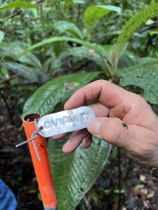
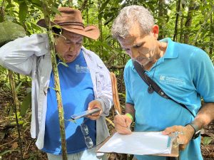
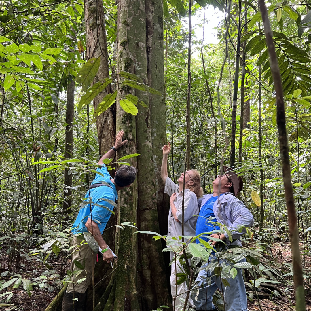
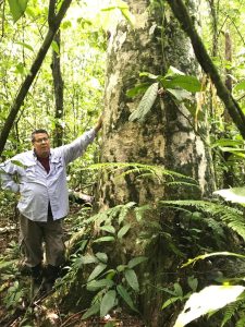
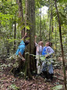
Field Work: Marking out the Canada Plot and measuring the surviving trees
The team completed field work in early 2025, with all the corners of the plots and subplots marked with PVC pipes and aluminum tags using an X-Y grid reference location system. All surviving trees of the species planted were measured for DBH, tagged with consecutive numbers, and located using the X-Y coordinates.
What is next for Phase 3?
The most significant outcome of this initiative was the rescue of the original data from the oldest known native tree forestry plantation in Costa Rica. With the publication of the data and metadata on the EDI platform, the information is now freely available to researchers to study properties of seedling establishment, growth, and early survival, or to develop new research questions. This successful project is part of an OTS-wide effort to rescue important data sets from OTS field stations and make the data freely available on indexed platforms such as EDI.
Acknowledgments
The team responsible for rescue of the Canada Forestry Research Plot at La Selva consisted of OTS staff and associates including B. Braker, D. McClearn, E. Castro, E. González, O. Jiménez, S. Rodríguez, and O. Vargas, with collaboration by staff of the TAMU-Soltis Center.
Epilogue: by Deedra McClearn
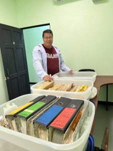
A few words about the importance of data repositories are in order. These packages are invaluable, as they contain raw data (original measurements) and relevant metadata such as maps, field notes, and photographs. “Legacy” (important information from decades gone by) and long-term ecological data can never be replicated, because they are unique to a specific time period. Even if papers have been published using the data, their charts and graphs can’t be used to ask new questions. The original numbers must be used. The original (“raw”) data must be used if synergies of data sets are planned (tree growth with weather records, for example). Furthermore, the maps and photos associated with the original data can provide critical information about changes in land use and extreme weather events.